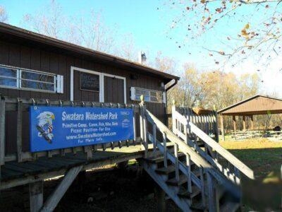
The Swatara Watershed Park is a 33.69-acre parcel along the Swatara Creek at 1929 Blacks Bridge Road, Annville (East Hanover Township, Lebanon County PA). The park is open year-round to the public from sunrise to sunset. The gates are open during the camping season which runs from May 1 – October 31. The park is open to foot traffic, with parking at the gate, the rest of the year.
- Camping
- Pavilion Rental
- Fishing
- Boat Access to the Swatara Creek
- Walking Trails
Camping
Swatara Watershed Park offers the following:
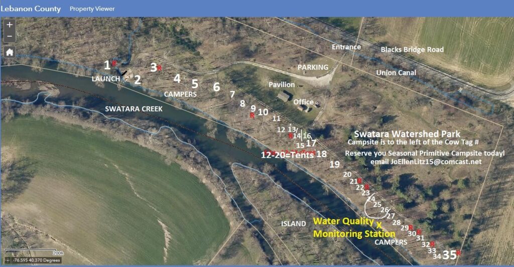
- 35 primitive creek side camp sites – there are no hookups of any kind
- RV/tent sites and tent only sites
- Drinking water access at the office and pavilion
- Portable toilet access
- Seasonal, monthly, weekly or daily rentals
Please read Camping Information 2025 for more information on renting a site. For availability and pricing, contact info@swatarawatershed.org or call 717-821-1681.
After confirming availability by email or phone:
- Complete the 2025 Camping Agreement
- Read Swatara Watershed Park Rules and Regulations 2025
- Submit payment via PayPal, mail check or arrange for cash payment via the above email or phone number
Pavilion
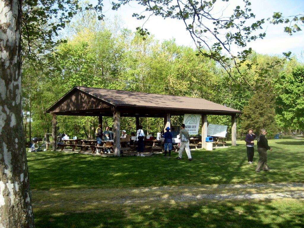
A 960 Sq Ft Pavilion with 10 picnic tables, electric, water and charcoal grills is available for rental throughout the season (May 1 – October 31). Email info@swatarawatershed.org or call 717-821-1681 for availability.
Fishing
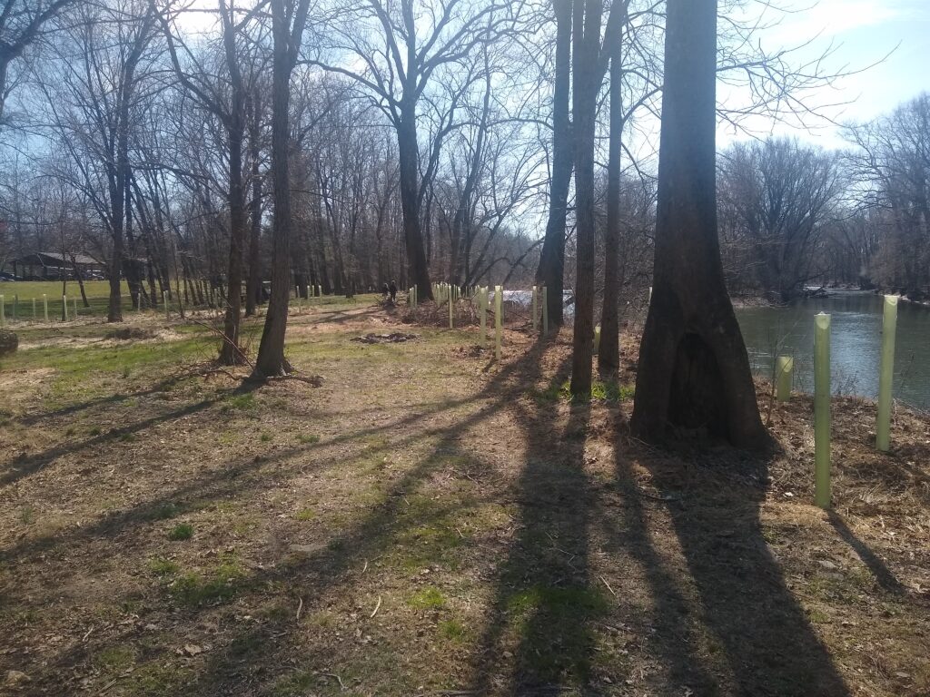
The park features 3341 feet of Swatara Creek frontage. A 15 ft. corridor along the creek is designated for public fishing. A PA fishing license is required per PA Fish and Boat guidelines. Tree tubes are present along the length of the stream to reinforce the existing riparian buffer. Tree tubes are not to be removed or destroyed.
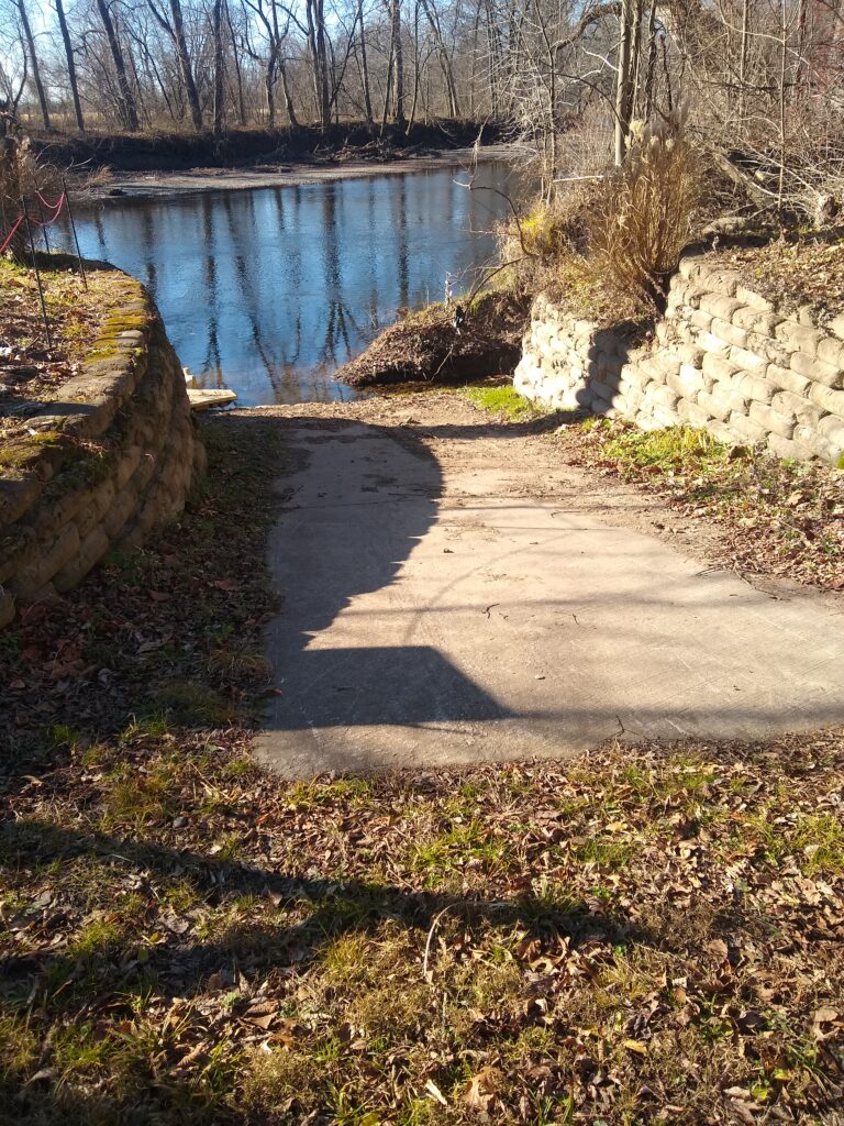
Boat Access
Because we often start or end our sojourn and river cleanup at this site each year, SWA considers this site an essential hub in the wheel of the Swatara Water Trail, which is recognized by both PA and the nation, and connects to the Captain John Smith Water Trail. Creek access is available to the right after entering the park. There is a concrete ramp and EZ Dock for launching paddle craft. Vehicles must be returned to the lot by the entrance after unloading.
Walking Trail
There is a mowed walking trail and gravel roads throughout the park that provide year round recreation opportunities. The trails are open to the public from sunrise to sunset.
A long-term goal is to become part of an inter-county trail system that could link to the proposed north-south rail-trail and east-west rail-trail linking Berks, Dauphin, Lebanon, and Schuylkill counties.
Flooding at the Park
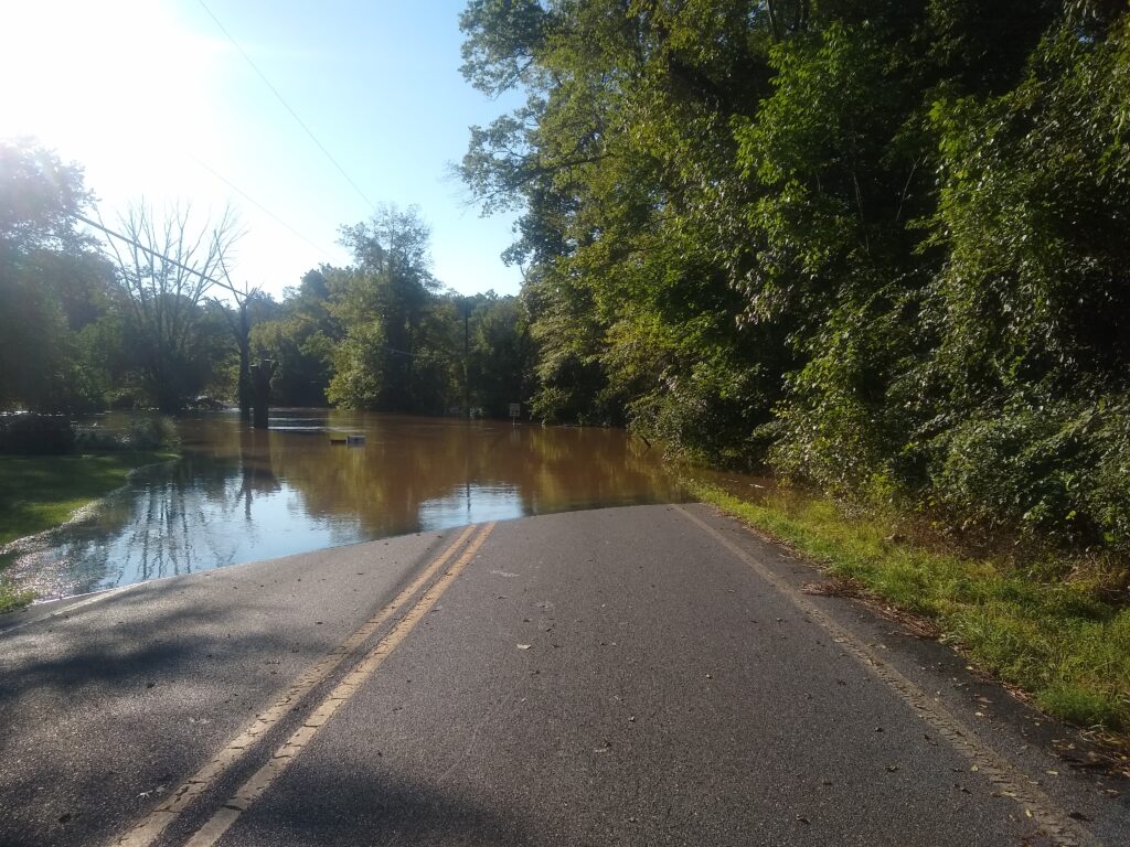
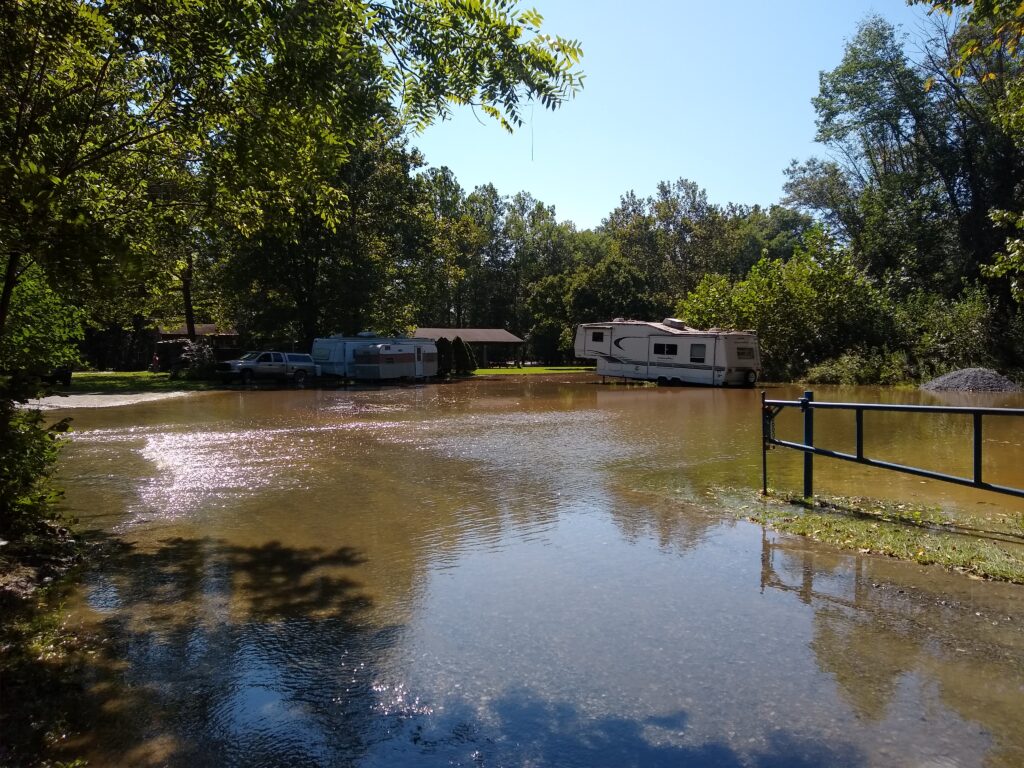
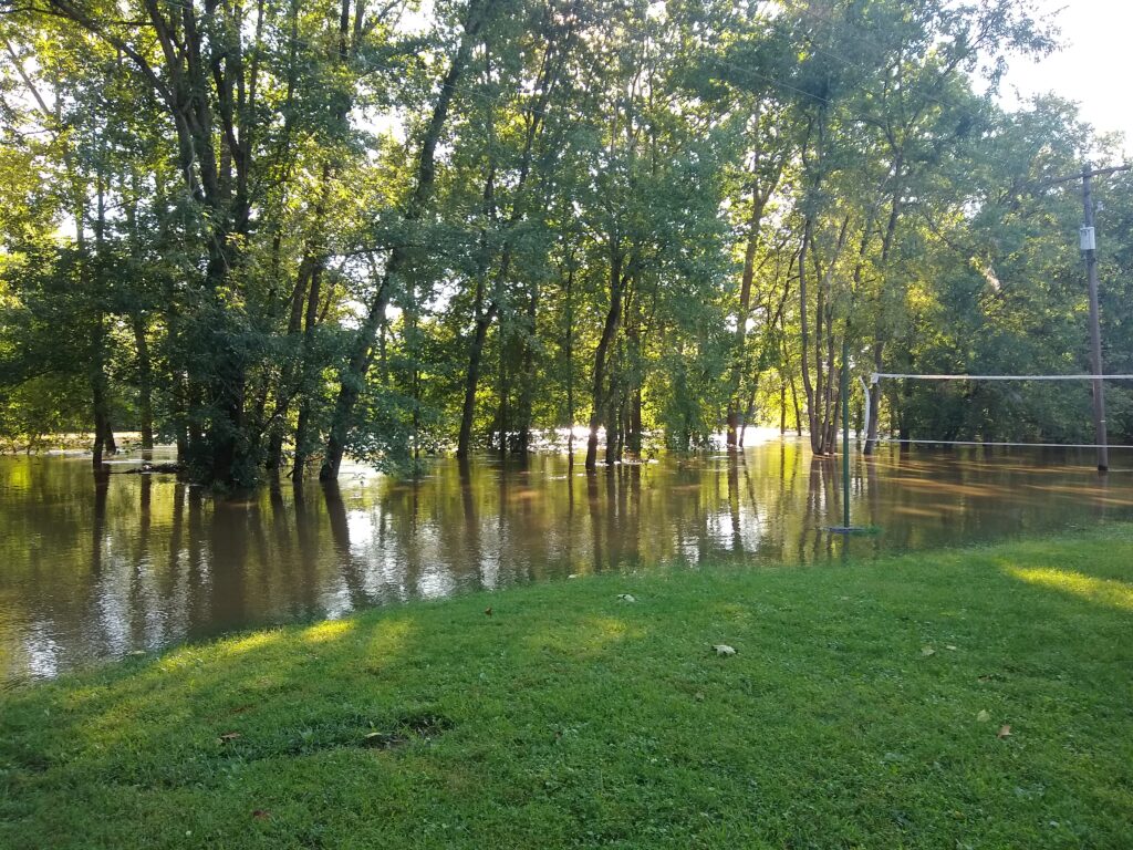
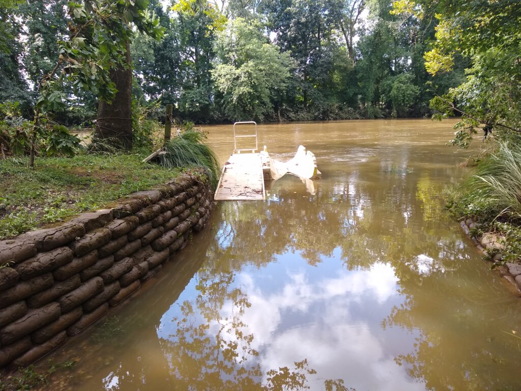
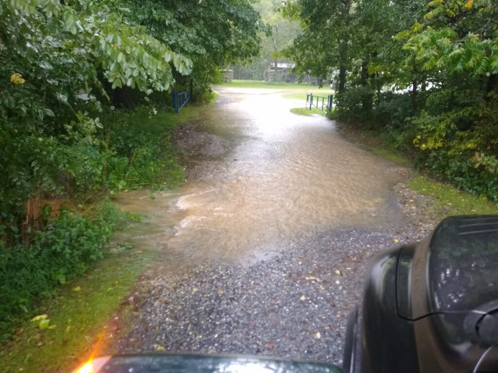
Extremely heavy rains, such as those experienced during tropical storms, periodically cause the creek to overflow its banks. All camping gear must be removed from sites when flooding is predicted.
| Creek Level at Harper’s Tavern | Park Impact |
| 5.5 ft | Roadway to Site 1 is inaccessible, mostly flooded |
| 7.0 ft | Boat ramp is covered to the top of the concrete |
| 9.0 ft | Sites 1-4 and 8 are flooded |
| 10.5 ft | All sites are flooded except sites 26-35, although these sites are inaccessible due to road flooding |